 Whatever your reasons for being on the trail—staying in shape, thrill and adventure, connecting to nature or history, relaxation and renewal—keep using them! You show your support by just being out there. And where trailheads have registries—please sign in. Government agencies review this log to determine user levels, which drives maintenance funding. A trail with a thousand visitors who can’t be bothered to sign in looks to the agency like an unpopular route. And if you can give more, please either make a donation to a trails group or join in the effort to keep our trails open.
Trail etiquette. When you happen upon other trail users, shout out a “hello” when you see them. This is particularly important if you’re on a bicycle, which can move along quickly and quietly, startling otherwise absorbed pedestrians or spooking horses. Always yield to equestrians—ask the riders where they want you to stand so they can pass by. Leave only footprints. Pack out trash to keep the trail pristine for future generations.
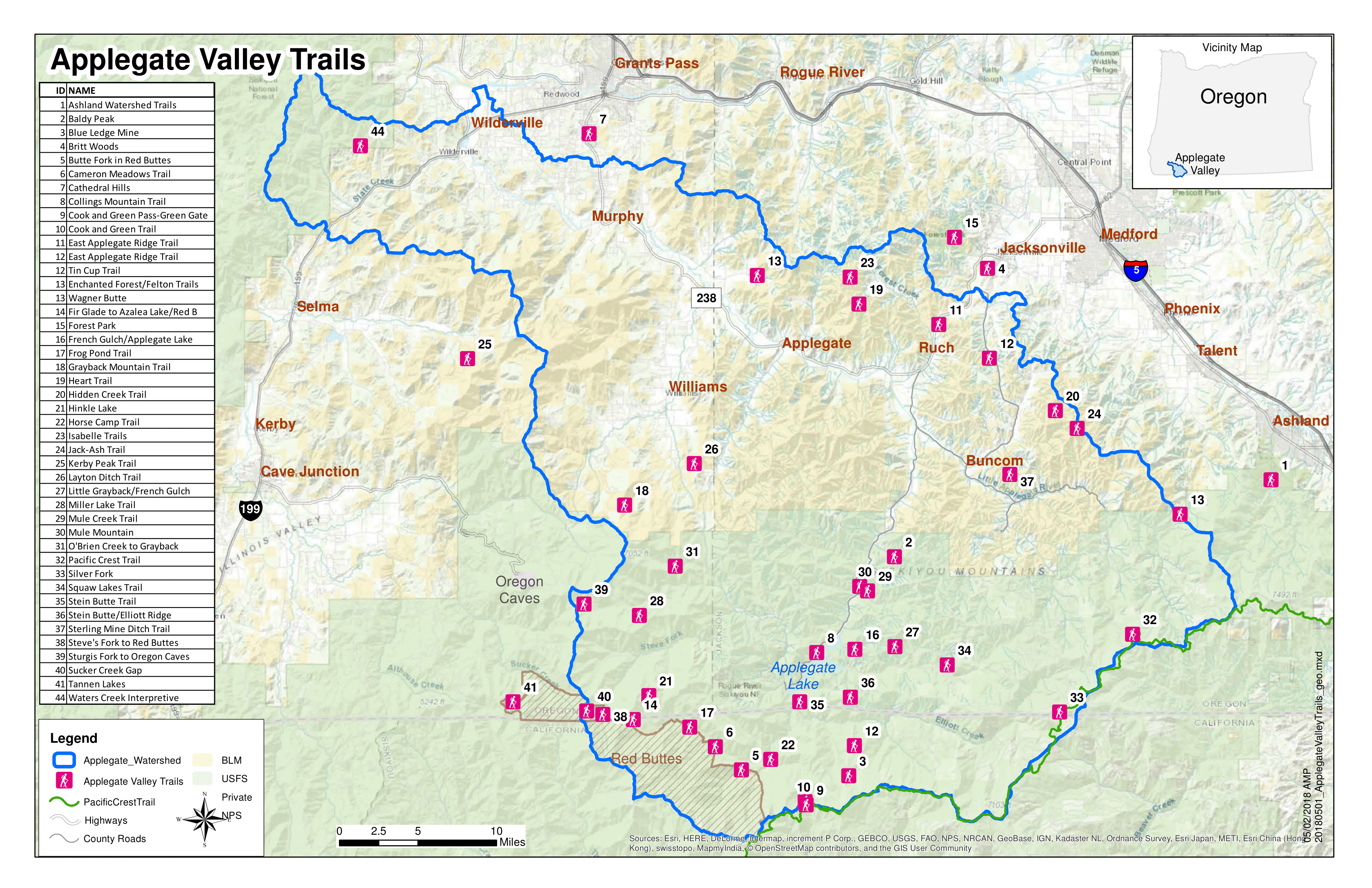
Many of the trails on this map are designated nonmotorized and many are shared with off-highway vehicles (OHVs), usually motorcycles. Please respect other trail users’ rights to use trails appropriately.
Please report adverse trail conditions like downed trees, trail damage from misuse, or illegally constructed user-built trails to the land manager (BLM or the US Forest Service) and the trail group associated with maintaining that trail.
The following organizations have partnered with either the Forest Service or the BLM to help maintain trails here. They have agreed to meet specific trail standards and safety practices, and they all do the essential work of keeping the trails open.
ATA. The Applegate Trails Association has an agreement with the BLM to help maintain the Applegate Ridge Trail. At this time (2018), a six mile section of the trail between Highway 238 and Sterling Creek Road—the East ART—has been completed. ATA is working with government agencies and private land holders to further the Applegate Ridge Trail from Highway 238 to the Cathedral Hills Trails near Grants Pass. ATA holds work trail maintenance work parties during the winter months. ATA also hosts guided hikes throughout the Applegate; visit www.applegatetrails.org for more information.
BCHO. Back Country Horsemen of Oregon has worked throughout the Applegate River watershed to both clear trails and pack in supplies and equipment for trail crews. You can reach them at www.bcho.org/chapters/sourdough-chapter.
MRA. The Motorcycle Riders Association has an agreement with the U.S. Forest Service to maintain trails in the Applegate Watershed. Visit www.motorcycleridersassociation.org for contact information.
PCTA. The Pacific Crest Trails Association maintains the Pacific Crest Trail as it skirts the southern edge of the Applegate River watershed, from the Red Buttes Wilderness to Meridian Meadows, headwaters of the Little Applegate River. Visit www.pcta.org for information about scheduled trail maintenance.
RVMBA. The Rogue Valley Mountain Bike Riders Association has agreements with the Forest Service, works on many trails around Applegate Lake, including Mule Mountain, Collins Mountain, Cook and Green, Little Grayback, and Stein Butte trails. Visit www.rvmba.org for information.
SMC. The Siskiyou Mountain Club helps to maintain trails in the Red Buttes Wilderness and beyond. In 2017 they worked on the Shoofly, Whiskey Creek, Butte Falls, and Boundary Trails. Visit www.siskiyoumountainclub.org to learn more about their wilderness trail maintenance work.
SOTA. The Southern Oregon Trails Aliance. Has an agreement with both the BLM and the Forest Service to maintain trails in the Applegate. SOTA has been working to keep Greyback Mountain Trails open. Visit www.sotrails.org for information about trail maintenance opportunities in the Applegate Valley.
SUTA. The Siskiyou Upland Trails Association has an agreement with the BLM to help maintain the Sterling Mine Ditch Trail, Jacks-Ash Trail, and Hidden Springs Trail, all located on the eastern end of the Applegate Valley, on and around Anderson Butte. SUTA is working with government agencies to extend the Jack-Ash Trail from Ashland to Jacksonville. SUTA holds trail maintenance work parties one Saturday each month from October – April. Work parties start at 8:30 AM and end with a SUTA provided lunch. Visit www.sutaorgeon.org for an events schedule.
WCFP. The Williams Community Forest Project has been working with the BLM to open the Layton Ditch Trail that winds across the foothills above Williams. Visit www.williamscommunityforestproject.org for more information.
Whatever your reasons for being on the trail—staying in shape, thrill and adventure, connecting to nature or history, relaxation and renewal—keep using them! You show your support by just being out there. And where trailheads have registries—please sign in. The agencies review this log to determine user levels, which drives maintenance funding. A trail with a thousand visitors who can’t be bothered to sign in looks to the agency like an unpopular route. And if you can give more—please either make a donation to a trails group, or join in the effort to keep our trails open.
Trail etiquette. When you happen upon other trail users, shout out a “hello” when you see them. This is particularly important if you’re on a bicycle which can move along quickly and quietly, startling otherwise absorbed pedestrians, or spooking horses. Always yield to equestrians—ask the riders where they want you to stand so they can pass by. Leave only footprints. Pack out trash to keep the trail pristine for future generations.
Many of the trails on this map are designated non-motorized, and many are shared with OHVs, usually motorcycles. Please respect other trail users’ rights to use trails appropriately.
Please report adverse trail conditions like downed trees, trail damage from misuse, or illegally constructed user-built trails to the land manager (BLM or Forest Service) and the trail group associated with maintaining that trail.
Written by Jim Reiland | Map by Annette Parsons
 People have been using trails for a long time. At some point we humans realized it was far easier to move through the forest or jungle, across the prairie or desert, or over the mountains along a path that was already worn. Trails freed us from the need to navigate an uncharted wilderness or negotiate obstacles and rough terrain. We followed them to hunt, forage for fruits and roots, and fetch water. Later we used trails to reach our fields, transport crops, and trade with neighboring villages. Before roads, trails connected us.

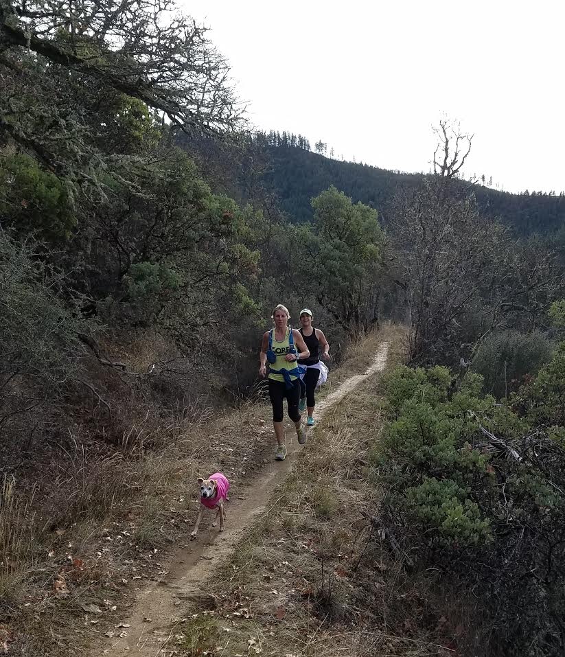
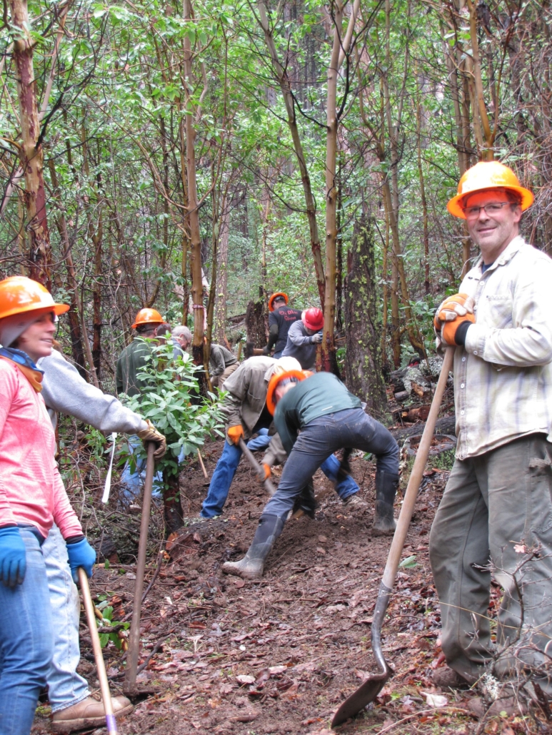

 Whatever your reasons for being on the trail—staying in shape, thrill and adventure, connecting to nature or history, relaxation and renewal—keep using them! You show your support by just being out there. And where trailheads have registries—please sign in. Government agencies review this log to determine user levels, which drives maintenance funding. A trail with a thousand visitors who can’t be bothered to sign in looks to the agency like an unpopular route. And if you can give more, please either make a donation to a trails group or join in the effort to keep our trails open.